


Winter snowfall and a few spring rains should provide sufficient soil moisture for seeding over much of Saskatchewan, but there will be a drier bias over southwest Saskatchewan this spring—according to Drew Lerner, a well-known agricultural meteorologist based in the United States.
Lerner spoke to farmers during a one-hour webinar sponsored by the Saskatchewan Wheat Development Commission.
Among the highlights:
-snowfall should take the edge off last fall’s dry topsoil conditions over much of eastern Saskatchewan and the northern forest fringe
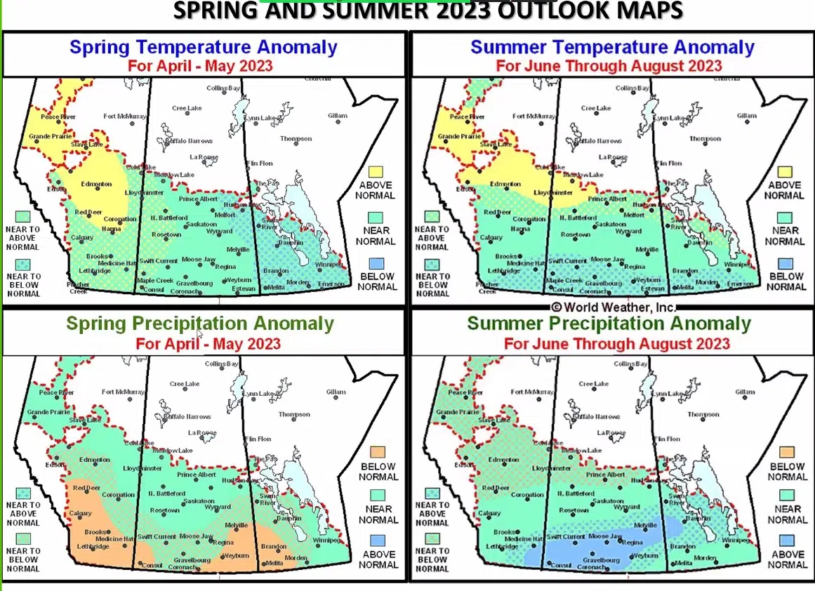
-April and May will be drier than normal in the Palliser Triangle (southwest Saskatchewan and southeast Alberta) following another winter of disappointing snow cover
-a high pressure ridge should result in better than normal summer precipitation in a band running across Saskatchewan. The location of that band will depend on the strength and location of that high pressure ridge.
-after two or three years of optimum harvest conditions, many areas could have more unsettled weather during combining.
-three years of La Nina is now over and is being replaced by a neutral phase.
-El Nino will be making a return—Lerner believes it will be in the fall or early winter.
Here is an excerpt from Lerner’s presentation on Tuesday, March 21st. (He refers to negative PDO which is Pacific Decodal Oscilliation, which is a robust, recurring pattern of ocean-atmosphere climate variability centered over the mid-latitude Pacific basin)
The map below is a screenshot taken from his webinar.