


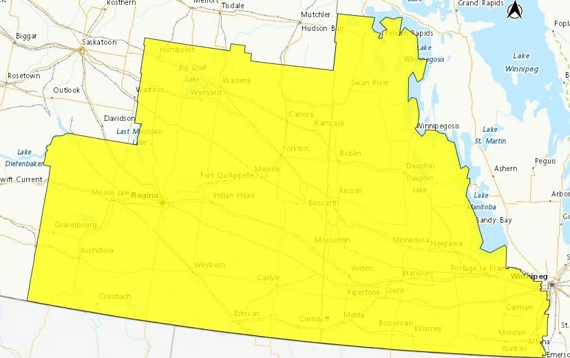
The winter storm expected in Saskatchewan is now more focused to the southeast corner of the province, including Regina, Humboldt, Yorkton and further south and east. It had earlier included much of southern and central Saskatchewan including Saskatoon and Prince Albert as part of a special weather statement, which has since ended, and now become a storm watch for the southeast.
A Colorado Low is expected late tomorrow night (Tues) through Thursday in the southeast as well as southwestern Manitoba. Environment Canada says about 10 to 25 cm of snow are possible, with the highest amounts over higher elevations. There will also be strong northeast winds, with gusts of 60 to 80 km/h expected, meaning blowing snow and reduced visibilities, which may make travel hazardous. The strongest winds are expected to be over the extreme southeast Saskatchewan and the Manitoba parklands, beginning Wednesday morning and then gradually tapering off overnight into early Thursday morning.
The storm will begin with rain mixed with snow, then turning to snow tomorrow night and the heaviest snowfall will be Wednesday morning. Total accumulations of all types of precipitation may exceed 30 mm for some areas.
CJWW Agriculture Director Neil Billinger spoke to Environment Canada meteorologist Terri Lang late Monday afternoon.